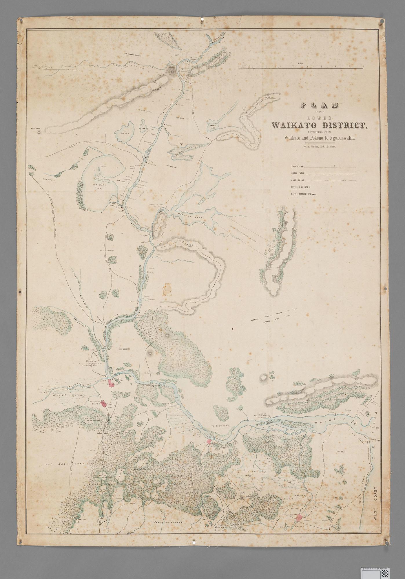
Plan of the Lower Waikato District Extending from Waikato and Pokeno to Ngaruawahia
Object type
Map
Production date
1860s
See full details
Object Detail
Description
Map showing tracks, settlements and mission stations
Accession number
HCLM_79
Subject auto tags
Object type
Part of 1 highlight set

Share
Rights
Many of the collection images are protected by copyright. For queries about permission to use images, please contact heritage@hcc.govt.nz.
Comments
Be the first to comment.