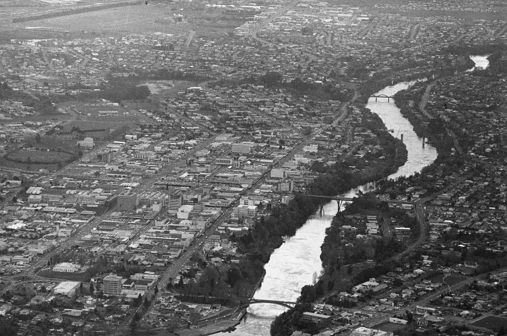
Aerial view of Hamilton city 1976
Object type
Photograph
Production date
01 Sep 1976
See full details
Object Detail
Description
This aerial photo from 1976 mainly shows the west side of Hamilton. Its coverage includes the Hamilton Central Police Station and Courthouses in the southwest, to Te Rapa racecourse and the suburb of Pukete in the north. On the east side coverage includes from the top of the old Riverina Hotel, then either side of River Road north towards Chartwell. Bridges visible are the Traffic (Victoria) Bridge, Claudelands Bridge, Whitiora Bridge and Fairfield Bridge.
Accession number
HCL_M00134.28
Subject auto tags
Object type
Part of 1 highlight set
Share
Rights
Many of the collection images are protected by copyright. For queries about permission to use images, please contact heritage@hcc.govt.nz.
Comments
Be the first to comment.